Friday, July 31, 2009

Homework


The LOFT

Learning Opportunities For Today (The LOFT) is the newly designed upstairs to the Larson Recreation Center. The LOFT
The LOFT was designed to provide a safe, comfortable, well supervised facility where a diverse group of youth can use technology, study, and interact in a positive environment.
The LOFT includes 10 computers all loaded with the latest software where anyone can access the Internet, work on homework, or just play with technology. All programs are for Middle and High School students’ ages 11-18 years old. Students 7-10 can drop in from 3:30-5:30 p.m. Monday-Friday to do their homework. After 5:30 p.m. on weekdays and weekends the LOFT is reserved for youth 11-18 years old.

The Homework Solution

Parents if you have problems getting your children to do their homework then bring them to the LOFT to sign up and have their name put on the chart. The LOFT is supervised everyday from 3:00 p.m.-8:00 p.m. They can get one on one help or use the computers to complete assignments.

Location
610 South Yakima
Moses Lake, WA 98837 .
For more information call:
(509) 764-6306
Hours of Operation
Monday-Thursday 3:00-8:00 p.m.
Friday 3:00-10:00 p.m.
Saturday 12:00-10:00 p.m.
Sunday 12:00-6:00 p.m. (or)
When Ice Rink is open 12:00-8:00 p.m.

Features of the LOFT
v 10 state of the art computers
v Internet connections
v Laser printer
v Full size pool table
v Fooseball
v Two 100” projection screens
v Homework stations
For more information on becoming a member of the LOFT go www.mlrec.com to get the Moses Lake Parks & Recreation Parent/Participant Handbook.

Thursday, July 30, 2009

Parks in Ephrata WA 98823


Oasis Rv Park and Golf Ephrata WA


The Oasis Park offers a variety of activities for kids of all ages.


The mini golf Course is open to the public and costs only $2 per person/per game and is located at 2541 Basin Street SW Ephrata WA (509) 754-5102.


In addition to the Mini golf course there is also a 9 hole course for adults. Also include in this oasis paradise is a children's playground, basketball court, hiking trails and a fishing pond for children.


THE FISHING POND

Is open from mid April through Labor Day. This pond is open so we can have the excitement of watching our children catch fish.


Banbino Park


Five acres, four baseball fields batting cage and two tennis courts


Located at 11th Ave SW


Ephrata Community Trails


10 miles of trails, four paved and six striped see http://www.blogger.com/www.ephrata.org for exact locations.


Ephrata Sports Complex


Four softball fields, 13 soccer fields, and playground equipment


Located A St. behind the Fire Station


Lee Park


Basketball court, playground equipment on 1.1 acres


Located on the corner of Lee St. and Smith Ave.


Lions Park
Four acres, sand volleyball, basketball court, horseshoe pits, playground, picnic shelter.
Located on Parkway Blvd.
Patrick Park
Basketball hoops, playground equipment, picnic shelter on four acres
Located at 1st Ave. NW and Patrick Rd.
Sun Basin Plaza
Gardens, pools, basalt columns, & murals
Located at Basin St. between 1st. Ave NW & Division St.

Warden Community Days Festival

* Thanks For The Community Support, See You Next Year! *


Warden Community Days

Warden, Washington

Directions:
121 S. Main St.
Admission & ParkingAdmission Charged for the Demolition Derby All events at the parks are free
Infophone509--349-7910

Tuesday, July 28, 2009

Parks


Parks in Moses Lake

Blue Heron Park- Former State Park
111 Westshore Drive
Moses Lake, WA 98837
Description: 3 Restrooms, Playground Area, 3 Picnic Shelters, Boat Launch, Picnic Tables, Unsupervised Swimming Area, Free Disc Golf Course and Fishing Bridge.

Cascade Park
2001 West Valley Road
Moses Lake, WA 98837
Description: picnic shelters, Boat Launch, Boat Moorage, Restrooms, and a Playground Area.

Cascade Campground
Located in Cascade Park
Description: overnight camping: 32 Tent Sites, 41 RV Sites, Group Camping Area, Bath House, Restrooms, Overnight Boat Moorage, and On-Site Caretaker

McCosh Park (Home of Surf’n Slide Water Park and Centennial Amphitheater)
401 West 4th Avenue
Moses Lake, WA 98837
Description: 6 Lighted Tennis Courts, Playground Areas, Picnic Area, Picnic Shelter, ADA Playground, Basketball Courts and Restrooms

Mini Parks

Carpenter Park
1522 Lee Street
Moses Lake, WA 98837
Description: Youth Practice Field, Playground Area, Basketball Court, and Picnic Area with BBQ Grill

Montlake Park
401 Linden Avenue
Moses Lake, WA 98837
Description: Playground Area, Picnic Shelter, Picnic Table, Boat Launch, Boat Moorage, and Restrooms

Knolls Vista Park
444 Knolls Vista Drive
Moses Lake, WA 98837
Description: Youth Baseball Field, Playground Area, Basketball Court, and Restrooms

Soap Lake Healing Waters


Soap Lake Healing Waters


The ice age created our lake. But in order to tell it like it really was, you have to understand the events which lead up to why Soap Lake is one of a kind.
By the time the last lobes of glacial ice actually reached down into what is now Washington about 13,000 years ago, the great Columbia River had cut a channel for itself from northeast to southwest across our state, having been pushed from its original bed into low-lying areas around the lava flows as they spread across the land.
Suddenly this enormous river experienced its first dam — one made of ice —; cutting off the flow of water near the site of Grand Coulee Dam.
For a time the water backed up into a huge lake, but the pressure soon forced an overflow and the torrents of water sought the lowest and weakest places in the terrain for their routes.
Again, the ancient river was forced to cut a new route, this time along what is now the Grand Coulee. A narrow gorge cut earlier by glacial run-off streams invited the rushing water toward the lake that covered what is now the Quincy flats. There the water slowed and deposited its heavy load of silt and gravel before rejoining its old bed near Crescent Bar.
Just at the site of Soap Lake there was what geologists call an anticline —; a hill. This anticline caused the heavy current to churn and tear at the underlying lava, digging a hole which was partially refilled with mud and gravel, and soon created a waterfall.
Many days of violent current cut the lava cliff further and further back in the direction from which the water flowed. Although the lava itself is very dense and hard, the many cracks formed while the rock cooled and the seams between the separate lava flows weakened the rock.
The waterfall which started at the Soap Lake anticline "walked" back upstream about twenty miles, leaving a series of plunge pools which are now lakes, before the water was suddenly gone as quickly as it had come.
When the ice dam broke or was pushed away, and the water of the Columbia reverted back into its old riverbed. The site of this final waterfall is appropriately named "Dry Falls" and is unrivaled by other geological remains as the site of the once greatest falls in the world.
Oil Painting of Dry Falls as it is now by © Judith Tramayne
Soap Lake marks the lower, or southern end of lower Grand Coulee, and Dry Falls marks the head of it.
But, as we know, the earth is never finished changing. Nature took its course and this little fresh water glacial lake with no outlet began to change after a few thousand years of receiving ground water seepage from the surrounding higher lava flows.
The volume of water in the lake stabilized by evaporation, but the many minerals in the lava were leached southward with the flow of ground water. At one time several of the lakes in the lower coulee had a high mineral content, but eventually because of its location at the lower end of the coulee, Soap Lake out did all the others.
At the time of the first known chemical analysis, the water contained 17 minerals.

Surf'n Slide Water Park

* Closed For The Season! Thanks For All Your Support! *


Surf’n Slide Water Park aka Moses Lake Aquatic Center

Come have some fun and beat the heat at Washington State’s Premier outdoor aquatic center. This family-oriented facility offers many activities and is designed for swimmers of all ages and abilities.

This state of the art water park features:
· The Flowrider (artificial surfing simulator)
· 300 ft Lazy River
· Children’s Splash Pad
· Large Deck and Patio Area
· Two 200 ft Water Slides
· Two sand volleyball courts
· Treasure Island Water Structure
· Baby Octopus Slide
· Children’s Playground
· 1 & 3 Meter Diving Boards
· American Red Cross Lifeguards
· Olympic-Size Competitive pool
· Tube Slide
· Full Service Concession Stand
· Security Lockers
· Handicapped Accessibility
· Picnic Shelter

This facility offers an American Red Cross Swim Program that teaches our children how to swim from beginners to those that want to become more proficient at all aquatic skills.

Surf’n Slide Water Park
401 South West 4th Avenue
Moses Lake, WA 98837
(509) 766-9246

Japanese Gardens

* Closed For The Season. Come Relax With Us Next Year! *


Japanese Peace Gardens

This is a park created by the City of Moses Lake and has features donated by Moses Lake Sister City in Japan, Yonzawa. It has 3 walking bridges and is multi-level. It has a Japanese Gazebo, lanterns, and a fountain. It is a very peaceful area to meditate.


Name: Moses Lake Japanese Peace Garden

Location (specific park it is located within):
Alder StreetCity: Moses Lake Washington
Fees: no

Movies in the Park

* Join Us Next Summer For An Array Of New Movies! *


Movies in the Park


Centenial Ampitheatre

Movies start at dusk
Admission:Free
Contact Information:
Park & RecPhone: (509) 766-9240

Silver Falls Hike


Silver Falls Hike

Round trip 1.8 miles
Elevation 700 feet

High point 3,100 feet

This is perhaps the most popular hike within the entire Entiat Valley, and Silver Falls is one of the prettiest cascades in all the Cascades. Silver Creek forms a silvery veil, dropping 140 feet over shiny granite slabs lined with pines. And while the falls themselves are a real treat, the loop trail leading to , below, and above them is sure to delight even more--especially children

The 2009 Soap Lake Hot Rod Reunion

See You Next Year!!!!
John Wayne Pioneer Trail (Iron Horse State Park)


You can hike, bike or horse ride, but it seems that biking is the most popular thing that is being done on this trail. The trail goes from North Bend, WA to the Columbia River. It will soon stretch all the way to either Coeur d'Alene or Tekoa, ID. It allows you to start any where you have a curiosity for. You can go through rainy passes, dark forests, a military test area of extreme desert or swamps. The trail is hard gravel and nearly level, so it is suitable for even novice riders. Mountain bikes do better than road bikes though.


There are NO FEES associated with the tail, but to cross the Yakima Firing Range you need to sign in at a kiosk on each end. Most trail heads have restrooms and water available; Hyak (at the Snoqualmie Summit) even has showers.


Going through the tunnel at Snoqualmie is very thrilling, as THERE IS NO INTERIOR LIGHTING (bring a light if you plan on entering the tunnel). At 2.3 miles, it is the longest tunnel open to non-motorized travel in the US. When you first enter the tunnel, your light will be pitiful, so you must have faith that your bike will not hit a rock or a wall.

DIRECTIONS:

Take I-90 past Ellensburg to Thorp. Leave I-90 at exit 101 and turn North on Thorp Highway. Travel 1/2 mile and turn left onto Thorp Depot Road. Travel 1/4 mile to the parking area.

BMX Track

The Larson BMX Track
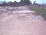
The larson BMX track layout is of a letter M style built by Billy Alen in the fall of 2004 and is an ABA sanctioned BMX track. The Moses Lake BMX track has been quoted as one of the best tracks in the state.

The Larson BMX track if host to around 20 races per year. Each race brings in athletes of all ages from all over the Pacific Northwest.

Located at 610 South Yakima Avenue

Moses Lake State Park Frisbee Golf


Moses Lake State Park Frisbee Golf


Disc golf is a lot like traditional "ball" golf, except players use specially made plastic flying discs instead of balls and clubs, and throw them for 'par' at an above-ground target instead of a hole in the ground. There are different types of discs used for different purposes, much like ball golfers use different clubs.
The object of the game is to throw a golf disc into the target, typically a "Pole Hole®" basket (a steel basket over which chains hang), in the fewest number of throws. The player begins by 'driving' from a designated tee area and continues toward the target, throwing each consecutive shot from the spot where the previous throw has landed. Finally, a successful 'putt' sends the disc into the target. The most satisfying sound a disc golfer can hear is the 'ching!' of a disc crashing the chains before dropping into the basket.

Concerts in the Park


Moses Lake Concerts in the Park


August 1st8:00pm - Juice Newton - Pop & Country Recording Star
August 8thStreet Dance at Sinkiuse Square Downtown
8:00pm - The Kingsmen - N.W. pioneers of rock & roll


August 15th8:00pm - Jimmie VanZant - Southern Rock
August 29th
The Moses Lake one day Blues Festival
Randy Oxford Band - Bluesy rock
8:00 - The Duke Robillard Band - rocking blues


September 5th
8:00pm - Hot Buttered Rum - Newgrass

The Gamers Lair


Here at "The Lair", our mission is to create a fun-filled and safe atmosphere where kids of all ages and their families can come to play, eat, chat, or just hang out. Be Comfortable!! Relax!! Enjoy!! We want to make our Lair - your Lair so there is no charge to come in and just hang out with your friends. While you're here, you might want to try the newest PC games or play our XBox 360's so we have lowered our prices just for you. Sit at one of our computer stations and play against your friends over our smokin' fast LAN network. Race your friends or play Rock Band on our huge 10 foot X 12 foot Big Screen. Play a game of Pool or Air Hockey, plan a party in our party room or just grab some food and hang with your friends. GET CREATIVE !!! Our walls are lined with black plastic and the whole Lair is filled with Blacklights and LED's. We have glow in the dark and neon paint available so release your creativity on our walls. Go Ahead... It's Okay.... Have Fun... Write On Our Walls... Leave Your Mark... We Don't Mind... in fact... We Encourage It !!! COME CHECK US OUT, WE'LL LEAVE THE BLACKLIGHT ON FOR YA! The Lair Staff
Located at: 7966 Andrews St. NE Moses lake
Hours: Sunday thru Thursday: 3-11pm
Friday and Saturday: 11-11pm

Sand Dunes


MosesLake
Sand Dunes


Name: Moses Lake Sand Dunes, WA (aka Grant County ORV area)
Location:
Four miles south of Moses Lake, WA
Description:
The Moses Lake Sand Dunes covers over 3,000 acres.
The sand dunes area is located on the southern tip of Moses Lake with rolling sand dunes and great fishing and waterskiing opportunities available.
Elevation - Sea level
Directions:
Four miles outside Moses Lake city limits in the sand dunes. Drive south on Division Street or take exit 174 off of I-90 and follow signs south.
Link to Mapquest Map for Moses Lake
Camping Area(s):
Camping is always free - public restrooms are on site.
Columbia National Wildlife Refuge

Columbia National Wildlife Refuge
Address: Refuge headquarters at, 735 E. Main St., Othello, WA
Phone: 509/488-2668
pacific.fws.gov/refuges/field/wa_columbia.htm
Category: Nature Preserves
Location: Moses Lake
Fodor's Review:
Columbia National Wildlife Refuge attracts a great number of birds: hawks, falcons, golden eagles, ducks, sandhill cranes, herons, American avocets, black-necked stilts, and yellow-headed and red-winged blackbirds. The refuge is also home to beavers, muskrats, badgers, and coyotes. Its 8 mi northwest of the town of Othello, about 20 mi southeast of Moses Lake.
· Cost: Free
· Open: Daily dawn-dusk; office open Mon.-Thurs. 7-4:30, Fri. 7-3:30

Wild Horse Monument

Grandfather Cuts Loose the Ponies -George, WA

Grandfather Cuts Loose the Ponies is a sculpture of 15 wild horses that has crowned a prominent Central Washington hillside for more than a decade and is an inspiring sight for travelers along I-90 as they enter Grant County from the west.


The 200 foot line of life-sized charging horses, a creation of David Goverdale of Chewelah,WA, captures a mystical spirit from a time when real wild horses roamed the steppes. The scene symbolically re-creates the Great Spirit turning loose a herd of wild horses above the Columbia River's Wanapum Lake.
The artwork can be seen from viewpoints along I-90, about 2 miles east of the Vantage bridge over the Columbia River.
The eastbound off-ramp has a rough path that leads a quarter of a mile to the Wild Horse Monument.
The westbound traffic only has a distant view; PLEASE DO NOT CROSS THE FREEWAY!!!!
Make a 10 mile loop by driving down to the freeway exit at the east end of Vantage Bridge, then drive east to the George exit to turn around.


Ice Skating Rink


Municipal Ice Skating Rink


Municipal Ice Skating Rink
City operated rink is 150' x 50' and admission is FREE! Open late-November through late- February (weather permitting). Ice skating lessons available through Moses Lake Parks & Recreation Department. Full service concessions on-site. 509.764.6306

Moses Lake Skate Park


Skateboard Park


This unique location features a "half-pipe," "ollie-box,""rail," and launch ramp. Open for skateboards & in-line skates (bicycles are prohibited). Facility is unsupervised. Happy grinding!
Located across from the Surf and Slide Water Park.

Moses Lake Museum and Arts


Moses Lake Museum & Art Center


MAC is a non-profit institution emphasizing the history and art of Central Washington and is supported by the City of Moses Lake and Friends of MAC.

The MAC is located at 228 West Third Avenue in downtown Moses Lake. Summer hours are 11am to 5pm, Monday through Saturday, and admission is FREE.

The Auto Museum

Memories Are Forever Auto Museum

The Auto Museum is home to over 100 cars form 1914 to 2007. We have cars in every category that guests of all ages will enjoy.
Best of all....admission is FREE!!!!

Open 1:00 pm - 5:00 pm
Monday - Saturday

Located at:
424 Burress Ave.
Moses Lake, WA 98837

Tel: (509) 764-8046

Monday, July 27, 2009

Dry Falls


Dry Falls is a prized geological wonder that was carved in the ice age by floods. The former waterfall (ten times the size of Niagara Falls) now forms a majestic cliff that is 400 feet high, 3.5 miles wide, and overlooks an oasis in the desert country side that is home to lakes and wildlife. Sun Lakes-Dry Falls State Park activities include 15 miles of hiking trails, bird watching, mountain biking, wildlife viewing and more. On the lakes, visitors enjoy fishing, boating, personal watercraft and swimming.

Family Fun


The Ginkgo Petrified Forest State Park is located on the barren rocky hills overlooking Wanapum Reservoir on the Columbia River. The area has an unusually high number of rare petrified wood trees, which were gradually formed when trees were buried in lava flows and then slowly transformed over thousands of years through the infiltration of silica and minerals. Taking on the shape of the wood and the colors of the minerals, the tree stumps became rock.

Grand Coulee Damn Highlights


Grand Coulee Damn is located

90 miles West of Spokane WA

230 miles East of Seattle WA

100 miles South of Canada


Grand Coulee Damn offers FREE tours of the dam and a laser light show that starts in the summer. For information and tour times call (509) 633-9265.


Visitor Center Hours

May 23 - July 31, 2009

8:30 am - 11 pm

Aug 1 - Aug 31, 2009

8:30 am - 10:30 pm 7 days a week

Sept 1 - Sept 30, 2009

8:30 am - 9:30 pm 7 days a week

Oct 1 - May 22, 2009

9 am - 5 pm 7 days a week


Laser Light show
Show times

May 23 - July 31, 2009 10 pm nightly

Aug 1 - Aug 31, 2009 9:30 pm nightly

Sept 1 - Sept 31, 2009 8:30 pm nightly

Oct 1 - Dec 31, 2009 OUT OF SEASON

Jan 1 - May 22, 2009 OUT OF SEASON


Friday, July 24, 2009

Hiking and Biking


Palouse Falls State Park:

Palouse Falls State Park is a 105 are camping park with a unique geology and history. It offers a droamic view of one of the state's most beautiful waterfalls that drops an astounding 200 feet, framed by 100 feet of basalt. It is the last remaining waterfall created by the ice age flood. Ater the falls the river streches 6 miles before reaching the Snake River.

Just above the falls are serieses of rapids and some littler waterfalls. The view of the rapids is easy to get to, just hike along the gravel path from the parking lot to several little foot paths.


Palouse Tribe Legend of Palouse Falls:


The Palouse River once flowed smoothly into the Snake, but four giant brothers, in pursuit of a mythical creature called "Big Beaver", speared the great creature five times. Each time Big Beaver was wounded, he gouged the canyon walls, causing the river to bend & change. The fifth time he was speared, he fought the brothers valiantly adn tore out a huge canyon. The river tumbled over a cliff at this point and became Palouse Falls. The jagged canyon walls show the deep marks of Big Beaver's claw.


Picnicking:
There is 1 sheltered area, 8 braziers & 10 unsheltered picnic tables on 2 acres of picnicking area. It comes on a first-come, first-serve basis.

Campsite Fees:
Standard: $15
Utility: $21
Primitive: $10
(these are per night w/ a max of 8 people per site)


Other Fees:
Second vehicle: $10
Dump station: $5 per use

Check in 2:30 p.m., check out 1:00 p.m. with quiet time is 10:00 p.m. - 6:30 a.m. and you may stay up to 10 days druing the summer & 20 days between Oct. 1 & Mar. 31.


Lake Lenore Caves


Lake Lenore Caves consist of 7 distinct caves, all easily accessible from the dirt trail. The caves were formed by the plucking of basalt rocks from the walls of the coulees during the recession of the last ice age. The caves were used thousands of years ago as storage and shelter for traveling prehistoric man.

Type
Length 3 mi
Difficulty 1/5
Rating 8/10
Gain 200 ft. Trail Map
Latitude 47° 31' 2.36'' N
Longitude 119° 29' 37.41'' W

PeopleHikers AccessibilityYear-roundCostParking is freeMapsUSGS: Park Lake, Soap Lake, Little Soap Lake
Driving Directions:
From Seattle, drive east on I-90 and take exit #151 to SR 283. Go through Ephrata, and continue on to Soap Lake. Turn north on Highway 17, and continue 8 miles to the

GPS Coordinates:
47° 31' 2.36'' N119° 29' 37.41'' W


Actual Prehistoric Rhino Found at the caves.